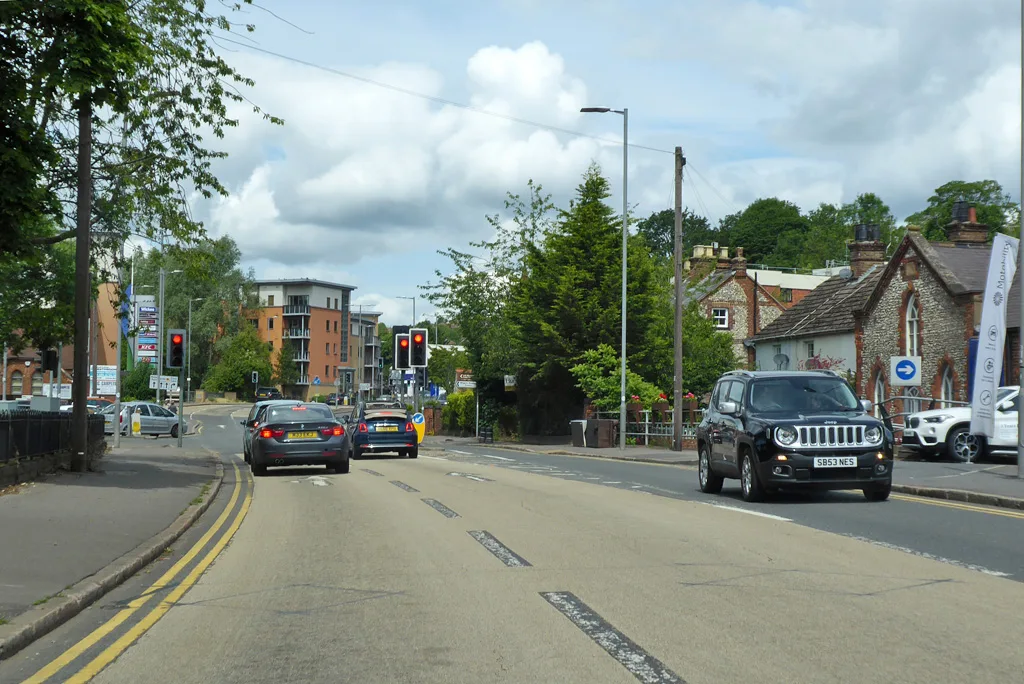

Eight flats next to 86 Gordon Road were refused on 26 August. Four reasons: surface water flooding, the Princes Gate junction and daylight loss at No 86.
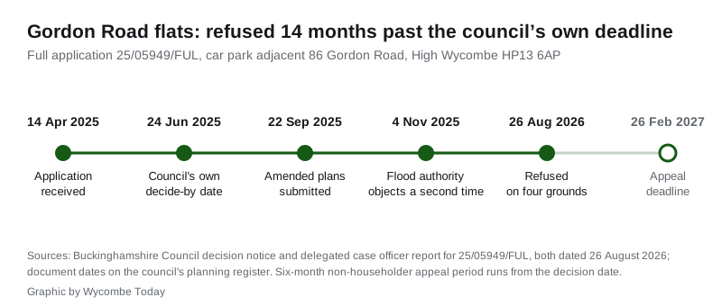
Buckinghamshire Council has refused a block of eight flats on the car park next to 86 Gordon Road in High Wycombe. It gave four separate reasons, and it took 14 months longer than its own target date to say so.
The decision notice for application 25/05949/FUL was issued on Wednesday 26 August 2026 and signed by Steve Bambrick, the council’s corporate director of planning, growth and sustainability. The case officer’s report gives a decide-by date of 24 June 2025. The scheme was a three-storey block of three one-bedroom and five two-bedroom flats, with landscaping and a widened drop kerb for a new access. The applicant is named on the case officer’s report as Streamdown Properties Ltd.
The site is an enclosed parcel of land north of 86 Gordon Road, postcode HP13 6AP. A railway line runs immediately behind it. Bowerdean Road School, which the council treats as a non-designated heritage asset, stands directly opposite, within 25 metres.
The four reasons for refusal
The decision notice sets out a schedule of four reasons:
- Harm to No 86. The block’s height, depth, scale and closeness to the shared boundary would cause “an unacceptable loss of outlook, an increased sense of enclosure and a harmful reduction in natural light” to habitable-room windows at 86 Gordon Road.
- The Princes Gate junction. Not enough information was submitted to show the proposed changes to the signalised junction would not harm “the safe and efficient operation of the highway network”.
- Flood risk. The applicant failed to show the development would be safe for its lifetime without increasing flood risk elsewhere, with gaps on surface water modelling, safe access and egress, floor levels, overland flow routes and drainage.
- The sequential test. The applicant did not demonstrate that no reasonably available site at lower flood risk could take the same development.
Reasons one and two cite the Wycombe District Local Plan of August 2019, which still governs decisions here. Reasons three and four cite Policy DM39 of that plan.
Why the flooding objection stuck
The land is not on a river floodplain. The case officer’s report records that it “contains areas at medium and high risk of surface water flooding”, with a further risk of groundwater affecting underground structures.
The council’s Lead Local Flood Authority objected twice, on 22 May 2025 and again on 4 November 2025, after the plans were amended. Its case was that the submitted flood risk assessment leaned on national flood maps, which the authority says are not detailed enough to judge risk to individual buildings. It asked for site-specific surface water modelling and, failing that, advised that sleeping accommodation be moved off the ground floor.
Two specific points did the damage. The assessment argued that an undercroft would let overland water keep flowing through the site, but the officer’s report says large parts of the building could instead act as a barrier, and no assessment of that bottlenecking was provided. And no flood emergency plan was submitted, so the council could not confirm that residents could get in and out safely during a flood.
Drainage was closer to resolved. Thames Water confirmed in a pre-planning enquiry that it would accept a maximum discharge rate of 1 litre per second; the scheme proposed 1.06 litres per second for a 1-in-100-year event, marginally above the cap. Infiltration drainage was ruled out because Network Rail guidance rejects it within 30 metres of a railway.
The junction, and what the council still wanted
The highway objection is about signals rather than the number of cars. The Highway Authority’s outstanding points, as summarised in the officer’s report, were the placing of signal heads and detectors for a proposed fourth arm at the junction, the risk of queues on Gordon Road backing up to the A40 roundabout, and whether pedestrian demand had been properly assessed during school peak times.
The authority also wanted the junction upgraded to SCOOT operation and linked to the adjacent Puffin crossing, and a replacement signal controller fitted. The officer gave this “substantial adverse weight”.
Three residents objected, raising overdevelopment, parking, congestion, loss of light, overlooking and precedent. Cllr Lesley Clarke, writing in May 2025, asked for the application to go to committee if officers were minded to approve it, said the eight parking spaces proposed fell short of the council’s own standard, and warned that a bin lorry would struggle to get in because it would have to pass under one of the flats. She also noted the site was a former oil storage depot. In the event the chairman of the West Buckinghamshire Area Planning Committee agreed the case could be settled by officers under delegated powers.
What the council accepted
The refusal was not a rejection of housing on the land. The officer’s report states the site forms part of the wider Netley Works allocation at 89 Queens Road under Policy DM21 of the local plan, so “the principle of residential development is established”, and the report gives substantial weight to the eight new homes.
Other objections fell away. The heritage officer raised none. The ecology officer accepted a biodiversity net gain of 20.8%, well over the mandatory 10%. Thames Water did not object. All eight flats met the nationally described internal space standards. The balconies on the five two-bedroom flats were 0.5 square metres short of the council’s 6 square metre standard, which the officer called minimal and gave only “limited adverse weight”.
The scheme fell because the highway and flood harms were rated substantial, and the harm to No 86 and the sequential test failure significant, which together “substantially outweigh” the benefits.
What it means for you
Nothing is built and nothing is settled. The applicant can appeal to the Planning Inspectorate, and because this is not a householder application the deadline is six months from the decision date, so Friday 26 February 2027. A fresh application answering the four reasons is also open to them, and the housing allocation on the wider site has not changed.
If you live on Gordon Road or use the Princes Gate lights, the highway reason is the one to watch. Any revised scheme has to satisfy the Highway Authority on the fourth arm and on queueing back towards the A40, which is a bigger piece of work than redrawing a block.
If you are drafting your own application anywhere in the district, the flooding reasons are the practical lesson. Being inside a local plan allocation did not exempt this site from the sequential test, because the officer found surface water flood data had been updated since the 2019 allocation and detailed surface water risk was unlikely to have been assessed at plan-making stage.
You can read and comment on live cases on the council’s planning register, and we track local applications and decisions in High Wycombe planning news.
Sources
- Decision notice for 25/05949/FUL, Buckinghamshire Council, 26 August 2026, for the refusal, the four reasons, the applicant’s agent and the appeal periods.
- Delegated case officer report for 25/05949/FUL, Buckinghamshire Council, 26 August 2026, for the site description, the consultation responses, the flood and highway assessments, the representations, the councillor comments and the planning balance.
- Application summary for 25/05949/FUL on the Buckinghamshire Council planning register, for the reference, the proposal, the address, the status and the decision date.
Have your say